Newest Chcnav RS10 High Accuracy Handheld Slam Laser with Gnss Rtk Ar Visual Survey System and Long Range Scanning

Customization: Available
Carrier Frequency: Dual Frequency Receiver
Number of Channels: Multi-Channel Multi-Channel Receiver

Product Description

i

Technical Specifications

Model NO.
RS10
Type
Geodesic Receiver
Working Time
1h (Single Battery)
Data Storage
512GB
Weight
1.9 Kg (Including RTK and Battery)
Laser Scanner Range
0.05 to 120 M
Laser Scanner Channel
16
Point Cloud Thickness
2 Cm
Effective Measurement Rate
320,000 Points/Sec
Scan Speed
10 Hz
Wavelength
905 Nm
GNSS Channels
1408 Channels
GPS Signals
L1c/a, L2c, L2p(Y), L5
Accuracy Assessment
Real-Time
P

Product Description

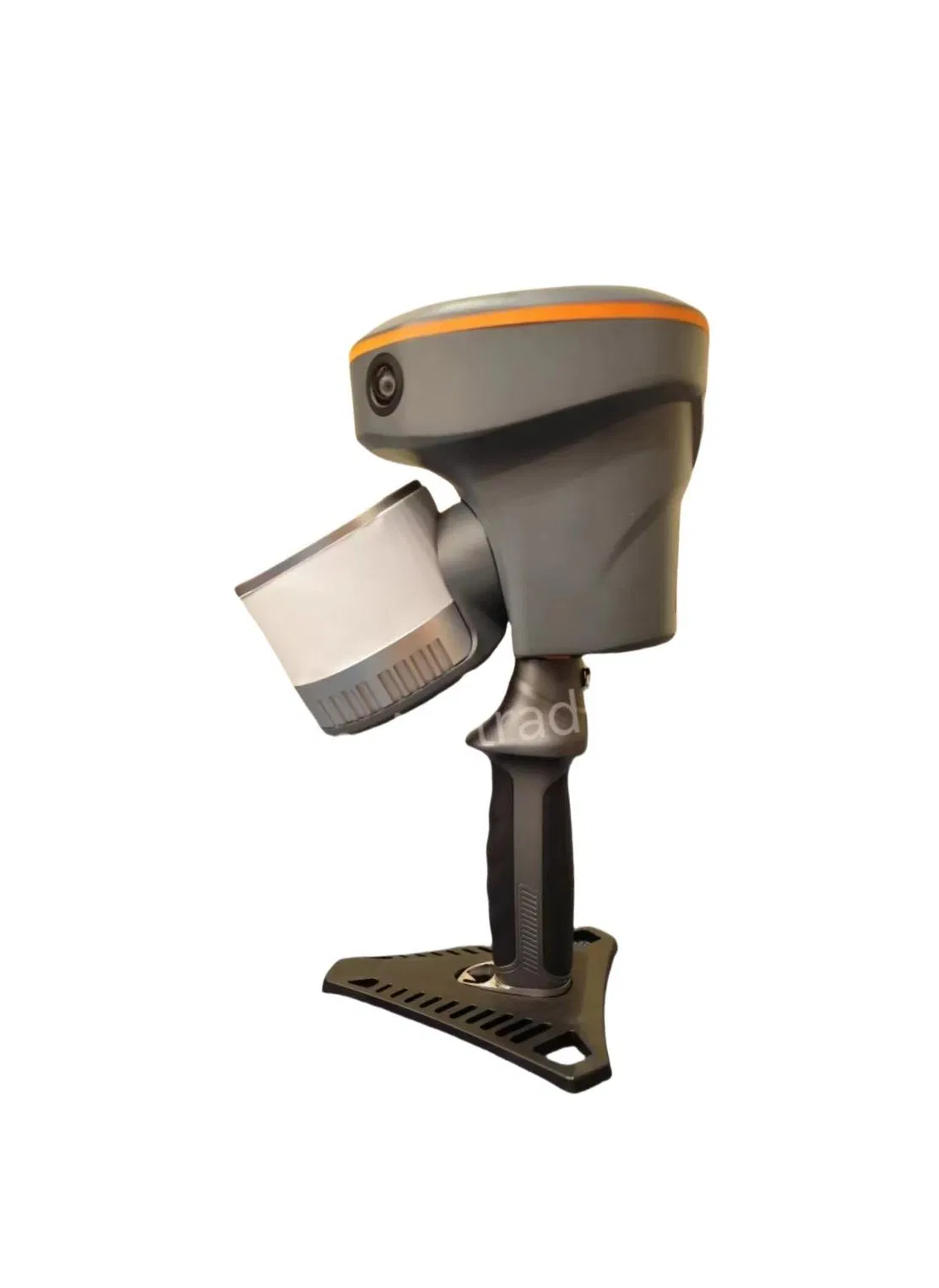
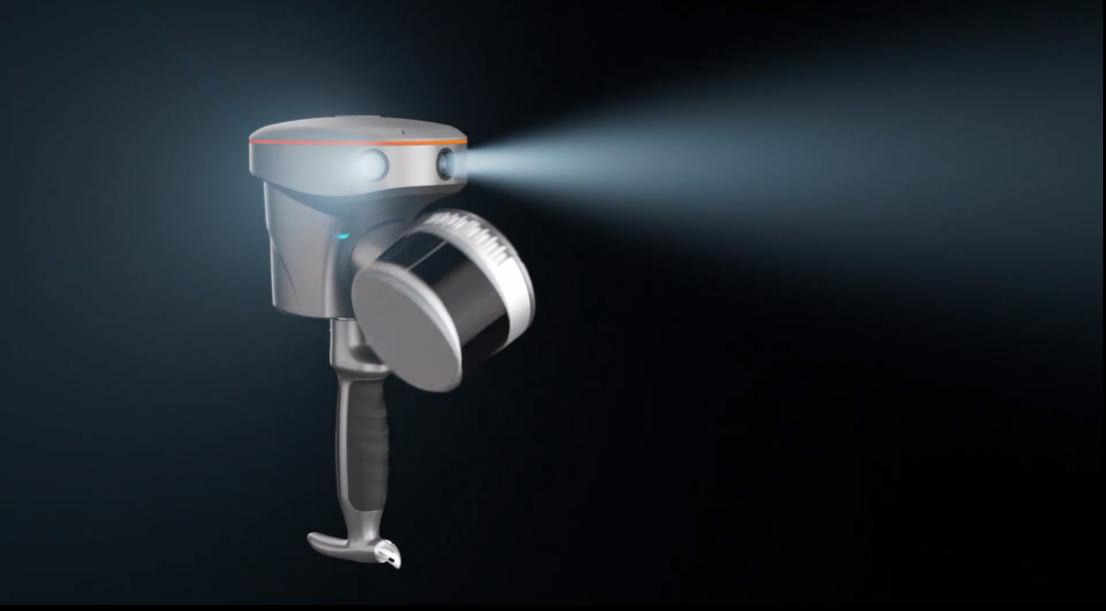
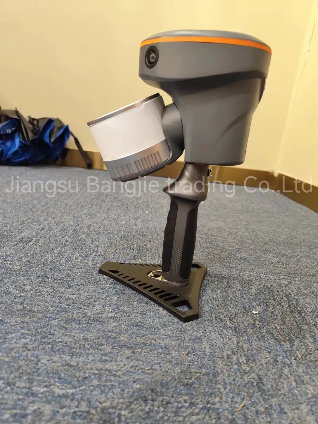
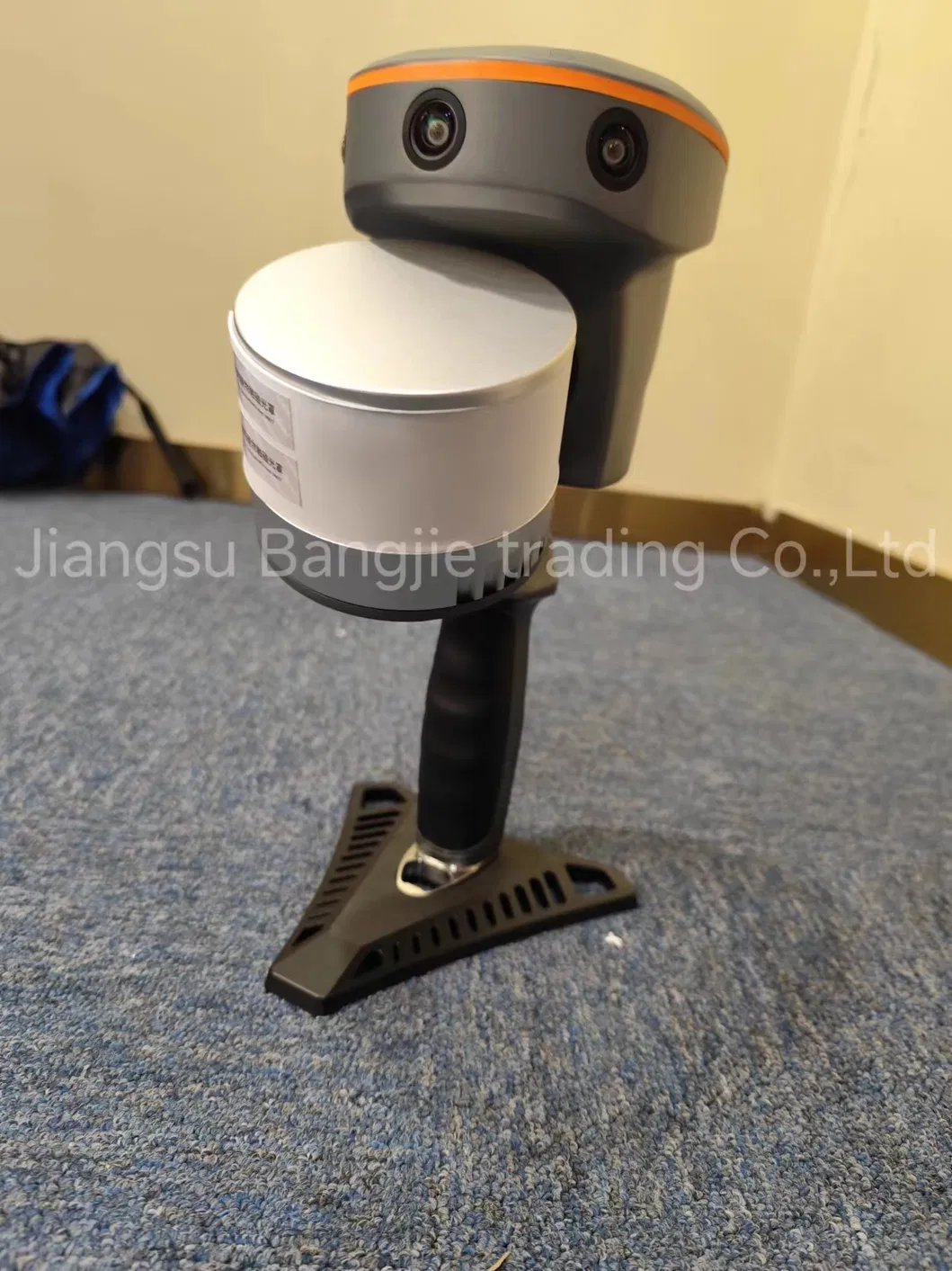
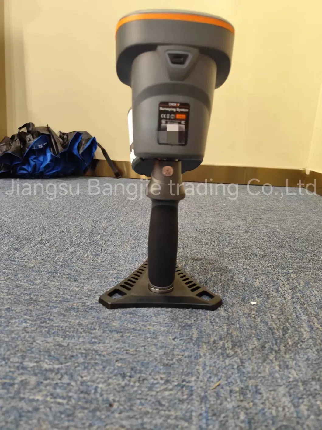
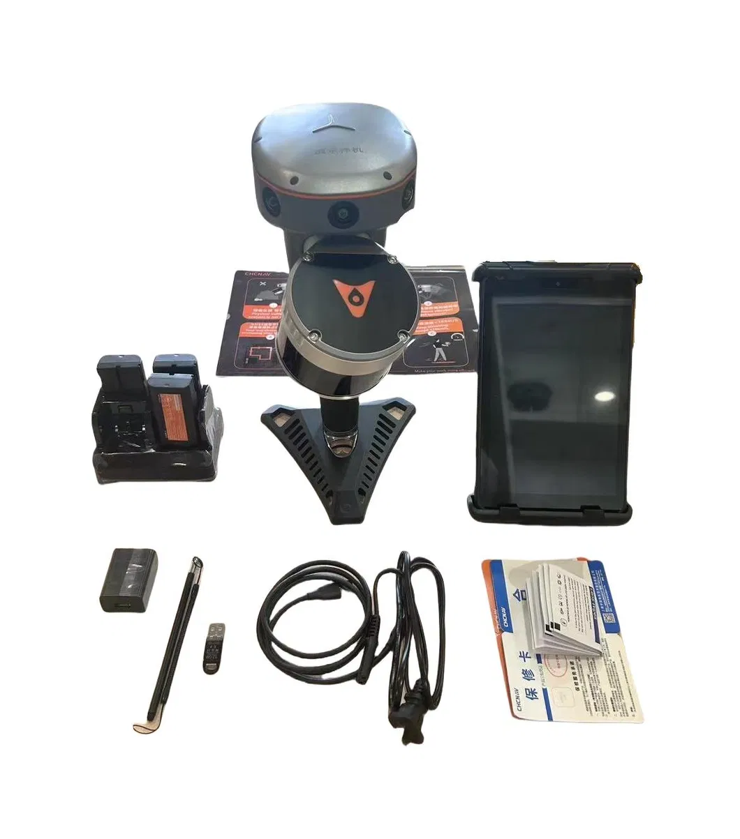
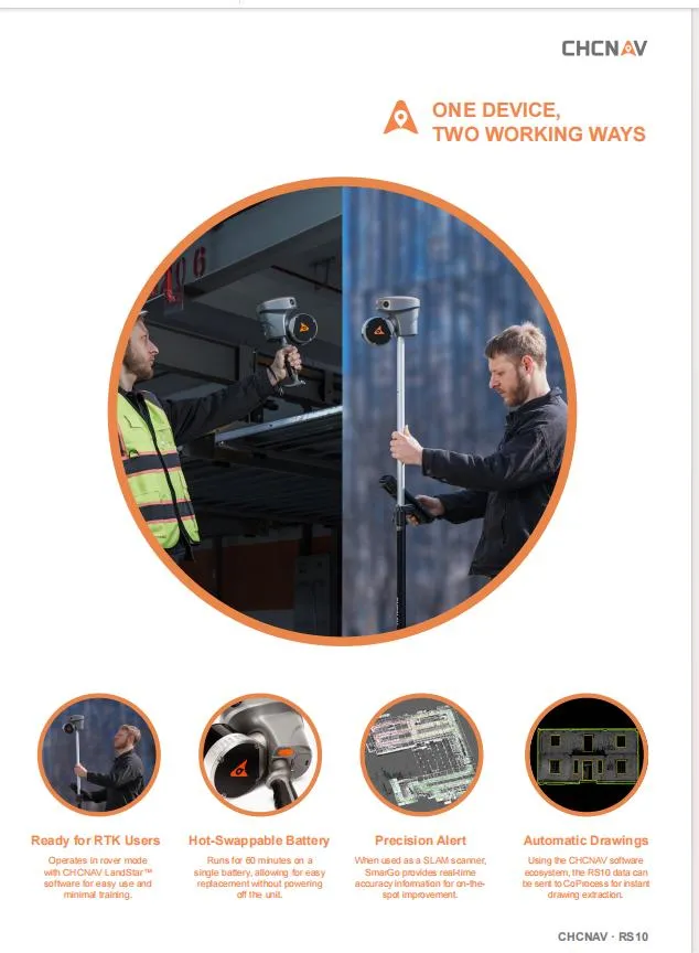
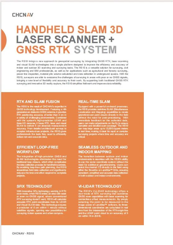
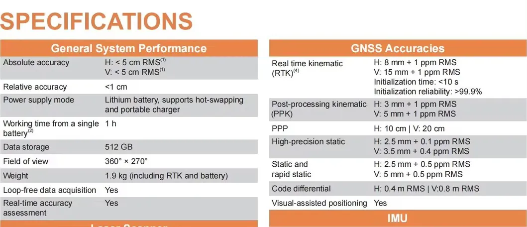
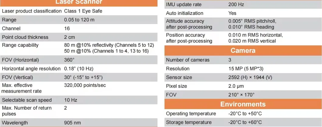
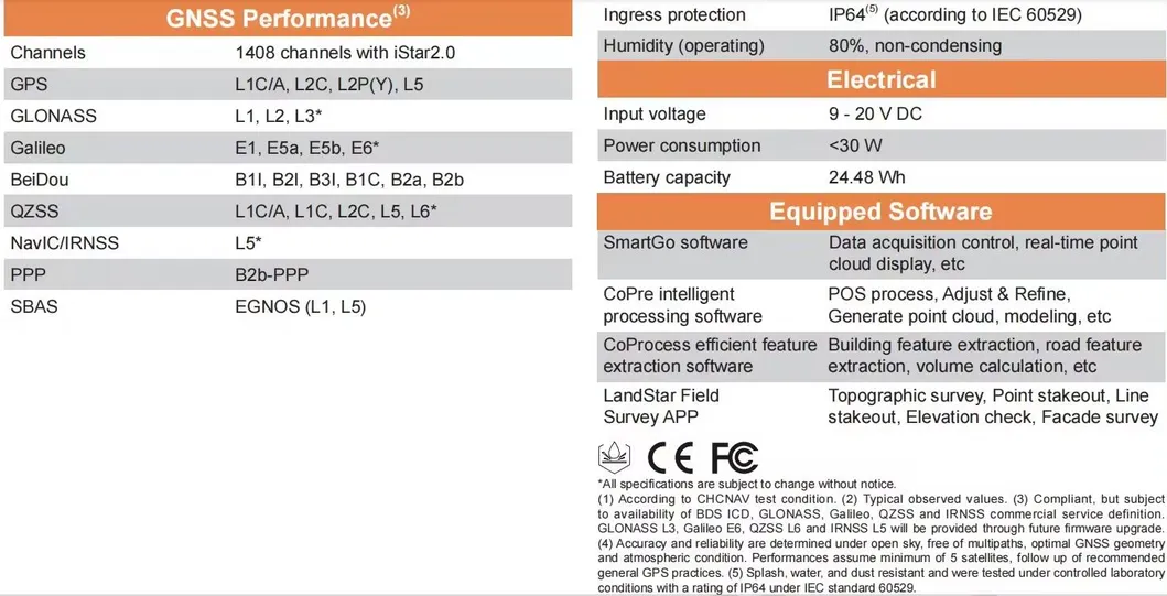
The RS10 is a high-accuracy handheld SLAM Laser system integrated with GNSS RTK and AR visual survey capabilities. Designed for long-range scanning and precision mapping, it offers a seamless workflow for professional surveyors. Featuring loop-free data acquisition and real-time accuracy assessment, this system ensures reliable results in diverse environments.

System Interface
Feature Banner 1
Feature Banner 2
Feature Banner 3
D

Packaging & Delivery

Package Size
55.00cm * 49.00cm * 28.00cm
Gross Weight
35.000kg

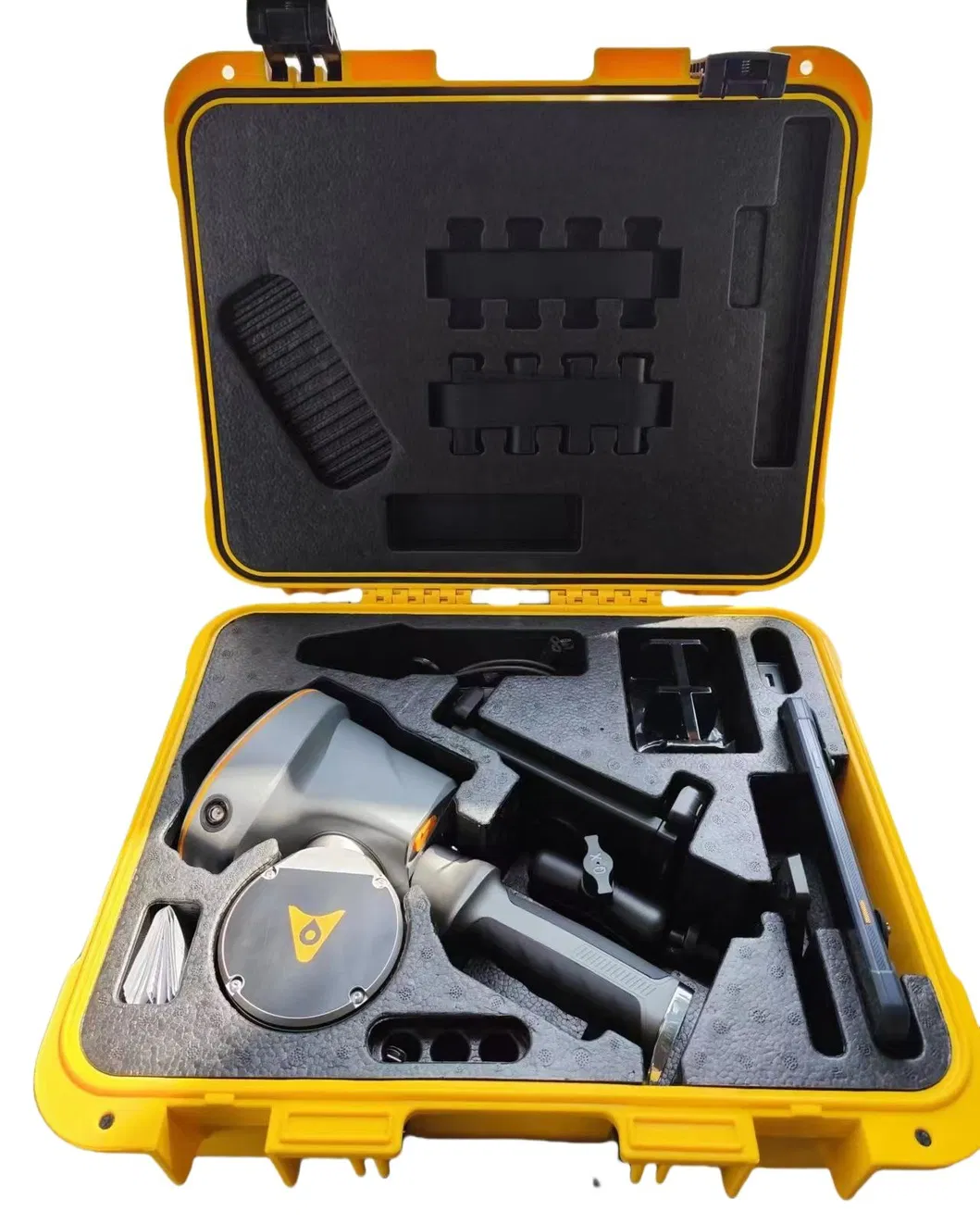
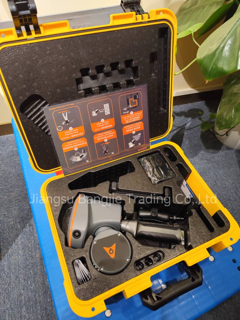
To better ensure the safety of your goods, professional, environmentally friendly, convenient and efficient packaging services will be provided.

?

Frequently Asked Questions

What are the primary scanning capabilities of the RS10?
The RS10 features a laser scanner range of 0.05 to 120 meters with a measurement rate of 320,000 points per second, utilizing 16 channels and a 905 nm wavelength.
Does the system support real-time data assessment?
Yes, the system is designed for loop-free data acquisition and provides real-time accuracy assessment during operation.
What GNSS signals can the RS10 receive?
It supports 1408 channels and is compatible with GPS L1c/a, L2c, L2p(Y), and L5 signals for high-precision positioning.
How much internal storage is provided?
The device comes equipped with 512GB of internal data storage to handle large point cloud files and survey data.
What is the weight and portability of the unit?
The unit weighs approximately 1.9 Kg, including the RTK module and battery, making it highly portable for handheld handheld survey operations.
How do you ensure the quality of the products?
We ensure quality through a rigorous process including pre-production samples and a final inspection of all components before shipment.

Related Products